• Skip to main content

Emery Water Conservancy District

Real-Time Water & Weather Data

  • HOME PAGE
  • Reservoirs
    • Adobe Reservoir
    • Huntington North Reservoir
      • Huntington Cleveland Irrigation Pipeline
    • Joes Valley Micro Hydro
    • Joe’s Valley Reservoir
    • Lower Mammoth
    • Millsite Reservoir
    • Olsen Reservoir
    • Teacup Diagram
    • Upper Huntington Drainage Reservoirs
    • Upper Huntington Drainage Teacups
  • Rivers
    • Green River (USGS)
    • Huntington River (Early Warning)
    • Muddy
  • Canals
    • Cottonwood
      • Blue Cut Meters
        • Blue Cut Meters 1 – 27
        • Blue Cut Meters 28 – 47
      • Clipper / Western Meters
        • Clipper / Western Meters 1 – 30
        • Clipper / Western Meters 31 – 57
        • Clipper / Western Meters 58 – 72
        • Group 1 Comm Status
        • Group 2 Comm Status
        • Group 3 Comm Status
      • Irrigation Waterline Pressure
      • Lower Mammoth Meters
        • Lower Mammoth Meters 1 – 28
        • Lower Mammoth Meters 29 – 56
        • Lower Mammoth Meters 57 – 84
      • Mill Ditch Meters 43 – 66
      • Poverty Flat Meters 1 – 10
      • Stock Water Line Pressure
      • Swasey
      • Upper Mammoth Meters
        • Upper Mammoth Meters 1 – 27
        • Upper Mammoth Meters 28 – 55
        • Upper Mammoth Meters 56 – 65
      • Western Canal Diversion
    • Ferron
      • Behling Pond
      • Clawson Diversion
      • Ferron North Ditch Diversion
      • MillSite Tri
      • Millsite Vault Outlet
      • Molen Pond Div
      • Tri-Structure Diagnostic
    • Hunter
    • Huntington
      • C 719 / C 720 Diversions
      • Gate 646
      • HCIC Irrigation Pressure
      • HCIC 2000 Line
        • HCIC 2006-2051
      • HCIC 2200 Line
        • HCIC 2200-2228
        • HCIC 2229-2257
        • HCIC 2258-2268
      • HCIC 3000 Line
        • HCIC 3042-3080
      • HCIC 4000 Line
        • HCIC 4002-4051
        • HCIC 4052-4092
      • HCIC 5000 Line
        • HCIC 5006-5060
        • HCIC 5062-5116
        • HCIC 5118-5140
        • HCIC 5501-5554
      • HCIC 6000 Line
        • HCIC 6000-6048
        • HCIC 6050-6094
      • HCIC 7000 Line
        • HCIC 7002-7030
        • HCIC 7032-7056
      • HCIC 8000 Line
        • HCIC 8002-8050
        • HCIC 8502-8550
      • HCIC 9000 Line
        • 9004-9506
      • North Ditch Diversion
    • Huntington Drainage
    • Huntington Drainage Teacups
    • Huntington Cleveland Salinity
    • Muddy Canal
      • Meters 1-9 & split
      • Red line 10
      • Red line 11
      • Red line 12
      • Red line 13
      • Red line 14
      • Red lines 15 & 16
    • Seametrics Comparison
    • South Lawrence Lateral
  • Weather
    • Agrimet Weather Stations
      • Castle Dale, Utah Agrimet Weather Station
      • Elmo, Utah Agrimet Weather Station
      • Ferron, Utah Agrimet Weather Station
      • Huntington, Utah Agrimet Weather Station
    • Candland Weather Station
    • Cloud Seeding
    • Grassy Flats Weather Station
    • Huntington North Weather Station
    • Joe’s Valley Weather Station
    • Little Creek Weather Station
    • SNOTEL Tabular Report
    • SNOTEL
      • Snotel Lookup
  • Cameras
    • Adobe Reservoir Cameras
      • Adobe Reservoir Cam
      • Adobe Dam Camera
      • Adobe Dam Face Cam
      • Adobe Outlet Gate Cam
    • Castle Dale N View
    • Castle Dale SW View
    • Huntington North Reservoir Camera
    • Joes Valley Control Area Camera
    • Joe’s Valley Reservoir Camera
    • Joes Valley Dam
    • Joes Valley Reservoir Glory Hole Camera
    • Lower Mammoth Reservoir Cameras
      • Storage Yard
      • Water Control Gates
    • Swasey’s Diversion Cameras
      • Straight Canyon
      • Swasey’s Diversion Entrance Camera
      • Swasey’s Diversion Pond Camera
      • Swasey’s Diversion Trash Area Camera
      • Swasey’s Diversion Trash Screen Camera
  • Reports
    • Battery Voltages
    • Full Stations Report
    • Monthly Reports
    • Repeaters
    • San Rafael River Study
    • Station Tabular Reports
  • Organization

HOME PAGE

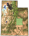
Emery County’s location in the State of Utah

utah

This website is sponsored by the Emery Water Conservancy District in central Utah. Emery County water resources are instrumented with solar powered weather, canal, reservoir, pond and river monitoring sites. The tools at this website give users of water immediate access to data from these sites. Better and timely information leads to better water management.

EWCD News

  • 2026 COTTONWOOD CREEK 1ST PRIMARY WATER ALLOCATION 0.0 AF/SHARE
  • 2026 COTTONWOOD CREEK 2ND PRIMARY WATER ALLOCATION 0.0 AF/SHARE
  • 2026 COTTONWOOD CREEK PROJECT WATER ALLOCATION 0.0 AF/ACRE FOOT

NOTICE IS HEREBY GIVEN that the Board of the Emery Water Conservancy District will meet in its official meetings on the following dates during the year 2026. Meetings will be held at 7:00 p.m. (Except as Noted below) at the New Emery Water Conservancy District office in Castle Dale, Utah

Board Meeting Schedule for 2026

  • January 26, 2026 7:00 pm ✓
  • March 23, 2026 7:00 pm
  • May 4, 2026 7:00 pm
  • June 22, 2026 7:00 pm
  • August 24, 2026 7:00 pm
  • October 26, 2026 7:00 pm
  • December 7, 2026 6:00 pm

Please email problems with web site to Jeff.tuttle@emerywater.gov

Staff

  • Monroe Magnuson – Manager
  • Jeff Tuttle – IT Specialist
  • Nacole Allen – Office Manager
  • Colton Grange – Laborer, IT Specialist
  • Dillion Walls – Laborer, Mechanic
  • Richard Cox – Operator, Laborer
  • Dillon Wilstead – Operator, Laborer

  • Home
  • Reservoirs
  • Rivers
  • Canals
  • Weather
  • Cameras
  • Reports
  • Organization

Maintained by Dynamic Integrations, Mount Pleasant, Utah
Created in conjunction with Rural Water Technology Alliance
Funded in part by USBR Provo Area Office

Log in